Morphology of the Val Ferret

Val Ferret is a straight glacial valley, parallel to the Mont Blanc chain. It stretches north-east for about 14 km, from Entrèves to the Col du Grand Ferret (2537 m), where the border with Switzerland is located.
The orographic right flank is dominated by the central sector of the long chain of Mont Blanc, which faces it with rocky ridges, terraces, glacial valleys, moraines. Among the numerous peaks: the Dent du Geant, the Aiguille de Rochefort, the Grandes Jorasses, the Aiguille de Lechaux, the Aiguille de Taléfre, the Aiguilles du Triolet, the Mont Dolent. The peaks and ridges that descend form five large glacial valleys that fall down towards the valley, with important glaciers: the Rochefort glacier, the Planpincieux glacier, the Frebouge (or Freboutze) glacier, the Triolet glacier, the Pré de Bar.
The left side (orographic) of the valley is wooded and, at high altitudes, rich in meadows and pastures. Also on this side there are valleys perpendicular to the main valley. In succession, proceeding towards the Col du Grand Ferret, we find: the valleys of Arminaz, Malatra, Belle-Combe. The peaks that close them are a separation with various districts (Morgex, Gran San Bernardo, Switzerland).
At the bottom of the valley flows, wide but not impetuous, the Dora di Val Ferret. The stream is fed by the melting waters of the glaciers and, as it exits the valley, it flows into the Dora di Val Veny to form the Dora Baltea.
Val Ferret from top to bottom

Proceeding up stream, from the mouth of the valley towards the Col du Grand Ferret, four sections can be distinguished.
- The first is the stretch from La Palud to Planpincieux. The beginning is marked by a bar that regulates the flow of cars. At this point the valley is characterized by a bottleneck formed by the slopes of the Mont Blanc chain and by the landslide side of the Mont de La Saxe. This is followed by a long straight stretch in progressive ascent between moraine deposits and sparse groves, exposed to avalanches. Beyond a prominence surmounted by two hairpin bends, you come to Planpincieux. The only real town in the valley, Planpincieux (1576 m), is made up of some chalets, old hotels and groups of huts, all perfectly restored, surrounded by fir and larch woods. From here, in winter, the long cross-country ski ring starts. The village is dominated by the famous Dent du Geant, the Rochefort ridge, and the buttresses of the Grandes Jorasses. On the opposite side, the steep but wooded side of the Mont de La Saxe faces it.
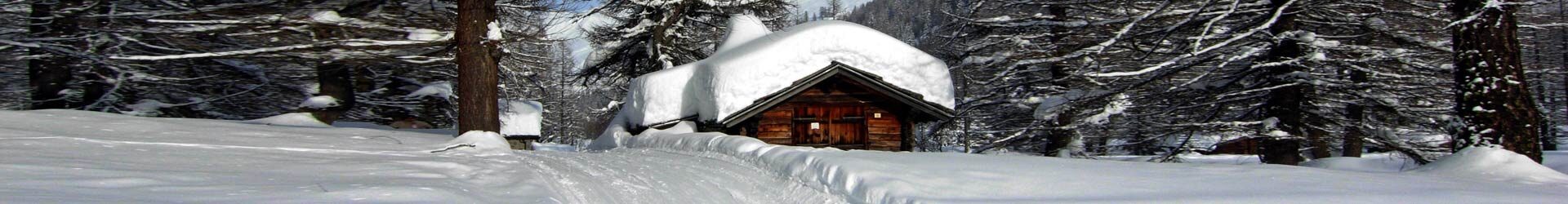
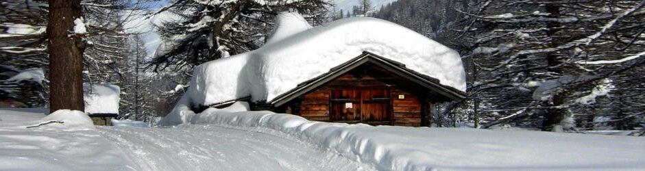
- The second part consists of a long valley floor of almost 3 km, up to the town of Lavachey, passing through the small town of Prà Sec (1630m). The valley manifests itself here in all its charm. Large meadows, woods and groves, streams, small groups of huts, a church, a few chalets for refreshment or lying in the sun. Above this part of the valley is the mighty presence of the Grandes Jorasses, while towards the end of the valley one can see the green peaks on the Swiss border. Behind you, towards Courmayeur, the greatest magic: the unforgettable silhouette of Mont Blanc with the serrated crest of Peutérey and, in the background, the mouth of Val Veny. The scene takes on very different shades according to the seasons: in the Summer, the contrast between the glint of ice and the intense green of the meadows is astonishing. In winter, the vastness and soft whiteness of the snow fields on which the eternal giants stand leave you breathless. Further upstream, continuing in the Val Ferret, is the village of Lavachey (1641 m) consists in a small group of huts and restaurants, a destination for walks and meals based on polenta and various dishes (chamois, sausage, cheese, etc.).

The road from Lavachey to Arnouva, covered with snow in winter The following stretch of valley leads after about 3 km to Arnouva, where the road ends. After Lavachey the valley shows a prominence, climbed by two hairpin bends. The next route is relatively flat, but wilder. The bottom of the valley features an alternation of meadows, groves and morainic terrain. The valley of Frebouge, with the beautiful Aiguille de Lechaux, overlooks the opposite side with the valley of Malatrà. Arnouva or Arpnouva (1776 m) is another small group of huts. In summer, the bus rides end here. Beyond, the road continues unpaved and closed to private traffic.
- The last section leads to the Col du Grand Ferret (2537 m) and to the border with Switzerland. The valley becomes narrower and absolutely glacial, to rise in the last part with the grassy slopes of the pass. Just beyond Arnouva, on opposite sides there are two other valleys: the valley of Triolet, with the Aiguilles de Talèfre and Triolet, and the valley of Belle-Combe, as narrow and horrid at the beginning as it is alpine at the top. The moraine terrain is crossed by the dirt road that leads to the Elena Refuge (2061 m), clearly visible at the top on the right. The last stretch is dominated on the left by the spectacular flow of the Pré de Bar glacier, surmounted by the elegant pyramid of Mont Dolent (3820 m), defined as the “mountain of the three nations” because of the borders of Italy, France and Switzerland.
Attractions in Val Ferret

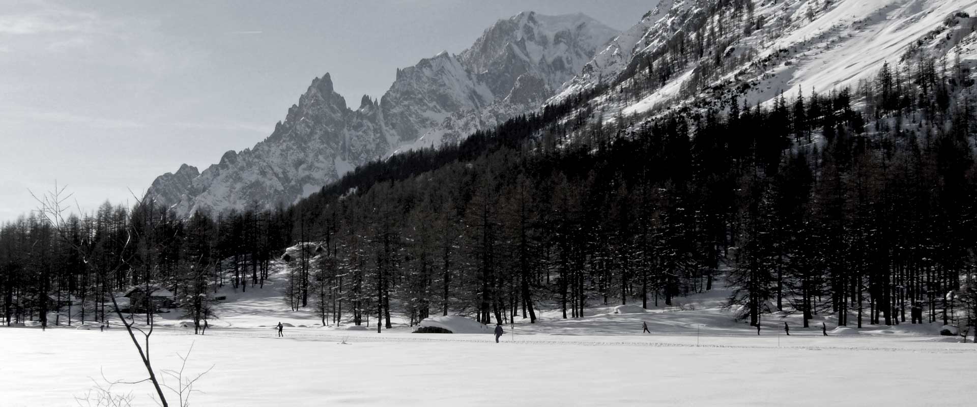
The Val Ferret is an area of high landscape and naturalistic value. Looking at it from its upstream end (Arnouva or the Col du Grand Ferret), it has the typical “U-shape” of glacial valleys. From the Val Ferret the Mont Blanc massif appears less looming than in certain points of the near Val Veny, but certainly no less impressive. From the Dente del Gigante to the Grandes Jorasses, up to Mont Dolent, it is a succession of glacial ridges, cirques and tongues, where ice and granite are the undisputed rulers. This universe of granite and ice contrasts in an exciting way with the green of the placid valley floor. With regards to wildlife, chamois and herds of ibex are frequent encounters, the latter easlily to be seen on the slopes leading to the Col du Grand Ferret. Sometimes, deer and roe deer can also be spotted and it is not rare to come across foxes and weasels around Planpincieux.
Activities and sports in Val Ferret

During the summer season, Val Ferret is the ideal terrain for excursions of all kind. The valley floor offers opportunities for short trips within everyone’s reach. The slopes and valleys on the left orographic side allow numerous itineraries from easy to difficult, which reach refuges (Bertone, Bonatti, Elena) and high-altitude passes. On the Mont Blanc side there are more demanding itineraries towards the refuges (Boccalatte, Dalmazzi) and the bivouacs (Gervasutti, Comino, Fiorio), some on the verge of climbing difficulties. One of the main stretches of the Mont Blanc Tour takes place in Val Ferret. The itinerary ascends from Courmayeur to the Bertone Refuge and continues at high altitude, climbing over the valleys on the opposite side of the Mont Blanc chain, up to the Bonatti Refuge. It then continues to the Elena Refuge and climbs to Colle du Grand Ferret, from where it leads to the Swiss Val Ferret. The route is very popular and it is not uncommon to come across hikers from all over the world. Mountain bike enthusiasts can choose from various itineraries, first of all the one that runs from Entrèves all the way on the valley floor up to the Elena Refuge. The more experienced, on the other hand, can take the Mont Blanc Tour itinerary also known as the “balcony path” because of the spectacular views that it offers, especially the section from Courmayeur-La Saxe via Testa Bernarda and Arpnouva to Col Ferret, indeed like a balcony overlooking the Mont Blanc massif, passing several mountain retreats (Rifugio Bertone, Baite de Arminaz, Rifugio Bonatti, Rifugio Elena) that offer food and beds. From the point of view of mountaineering, Val Ferret is the setting for many classic itineraries, such as the ascent to the Dente del Gigante, the Rochefort ridge, the normal route to the Grandes Jorasses and the normal route to Mont Dolent. In addition, in the Triolet valley, numerous modern climbing routes have been opened around the Dalmazzi Refuge. For lovers of cliffs and free climbing, beautiful equipped walls can also be found near Arnouva, where the carriage road ends. But Val Ferret is not an environment only for people who walk or ride. Also fans of fishing, golf and horseback riding are at ease here. In fact, the stream that flows in the valley is a fishing reserve for a long stretch, where you can catch trout and char. The game of golf is played in the beautiful nine-hole golf course that extends near Prà Sec. A true wonder at the foot of the Grandes Jorasses. During the winter season the valley turns into a paradise for cross-country skiing and snowshoeing. From Planpincieux begins the long ring of the cross-country skiing which, when conditions allow it, reaches Arnouva. Cross-country skiing lessons also take place here. Danger of avalanches permitting, the mountains and valleys on the opposite side of Mont Blanc are one of the best environments for ski mountaineering. Moreover, some more interesting climbs also take place in the group, such as the one to Mont Dolent. In Val Ferret one can also practice dog sledding, on sleds pulled by dogs.
Connections and centers in Val Ferret

Val Ferret is connected to Courmayeur by a carriage road, which from La Palud onwards (uphill) represents the continuation of the Larzey-Entrèves municipal road. The road can also be taken from State Road 26 by turning right before reaching the access to the Mont Blanc tunnel (on the Italy side of the mountain).
In Summer, access is almost always regulated by a roadblock to be found after La Palud. There is a limit to the number of cars that can access the Val Ferret in the Summer, and when this limit is reached car access closes and private vehicles can be left at a parking lot to continue by walk or public transport. The shuttle bus serves the localities of Planpincieux, Lavachey and Arnouva, all to be found along the road that follows the bottom of the valley.
In winter the road grants access to the valley only by shuttle bus (no private cars allowed), but is limited to Planpincieux. To go up it is therefore necessary to use the shuttle bus (part of the local public transport network) to Planpincieux. In the Winter, indeed, the section of the valley that goes from Planpincieux to Lavachey, and onward to Arnouva (or Arpnouva) is turned into a cross-country ski track.
The inhabited centers in the valley are Planpincieux, Prà Sec, Lavachey and Arnouva.
Planpincieux is the only center that is reached by local services, such as shuttle bus from Courmayeur. Prà Sec, Lavachey and Arnouva, a collection of houses that once served mainly as shelters in the mountain pastures, today offer bed and breakfast, meals and snacks to trekkers and excursionists venturing along the valley or walking the Mont Blanc circuit.
The small population is due to the fact that Val Ferret is a protected area and therefore further urbanization is not allowed. Moreover, this area is hard to reach in the winter. During winter months, in fact, the bottom of the Val Ferret, especially the first leg, is exposed to high risk of snow avalanches, making it necessary, at times, to completely close access to the Valley, also to allow securing the road.
Services and support points in Val Ferret
Val Ferret is served by a shuttle bus line departing from Courmayeur and Entrèves to Arnouva. The service operates during the Summer and Winter seasons. In the Winter season, the line is limited to the locality of Planpincieux due to the snow. Indeed, in the winter, the road from Planpincieux to Lavachey is turned into a cross country ski track. Buses stop at each and every inhabited centers, parking areas of the valley and at the starting point of main trails.
Val Ferret is equipped with all the facilities and services for Summer and Winter tourism.
In Planpincieux there are a few hotels, excellent restaurants, bars, and shops where it is possible to rent or buy skiing and biking equipment, and the so called “Foyer de Fond” – a changing room/locker room for cross-country skiers.
Chalets, small restaurants and refreshment points can be found in refurbished huts along the road from Planpincieux to Lavachey. A little beyond Planpincieux there are also points of sale for typical cheeses.
The refuges are numerous. Some serve as support points along the Mont Blanc Tour, their names are “Bertone”, “Bonatti”, “Elena”. Others are located on the slopes of the Mont Blanc range, perched in the middle of the glaciers as the “Torino”, “Boccalatte” and “Dalmazzi” refuges or the bivouacs (one-night shelter with no services) as the “Gervasutti”, “Comino” and “Fiorio”. Some, such as the “Canzio” and “Jachia” bivouacs, are located in daring positions and can only be reached by good climbers.
As already mentioned, one of the most boasting facilities in the whole valley is the Courmayeur et Grandes Jorasses Golf Club, a magnificent golf course at the foot of Mont Blanc.